SiteTwin · construction progress monitoring
Your site, every fortnight,
in 4D.
We fly the same waypoints on a fixed cadence, process the data offline, and your private link updates itself: a dated timeline, before/after compare, a 3D scan you can orbit, and a report your RERA filing can use. You open a link. That's the whole job on your side.
Live demo · real client data
This is what you'd open.
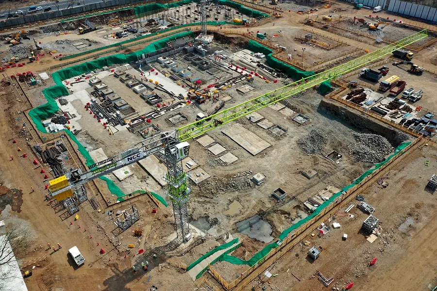
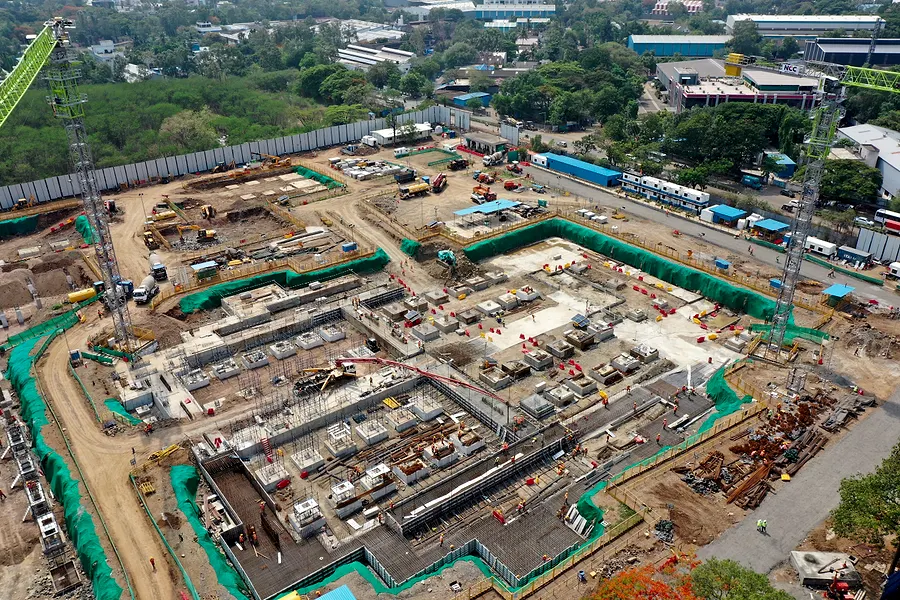
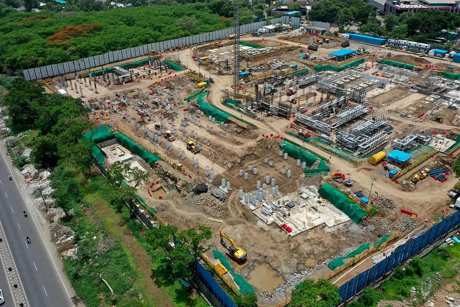
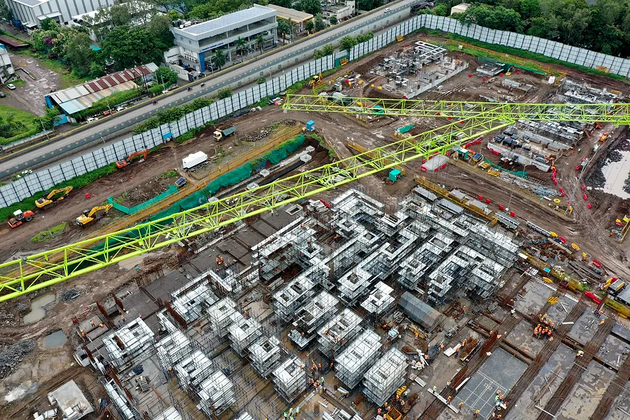
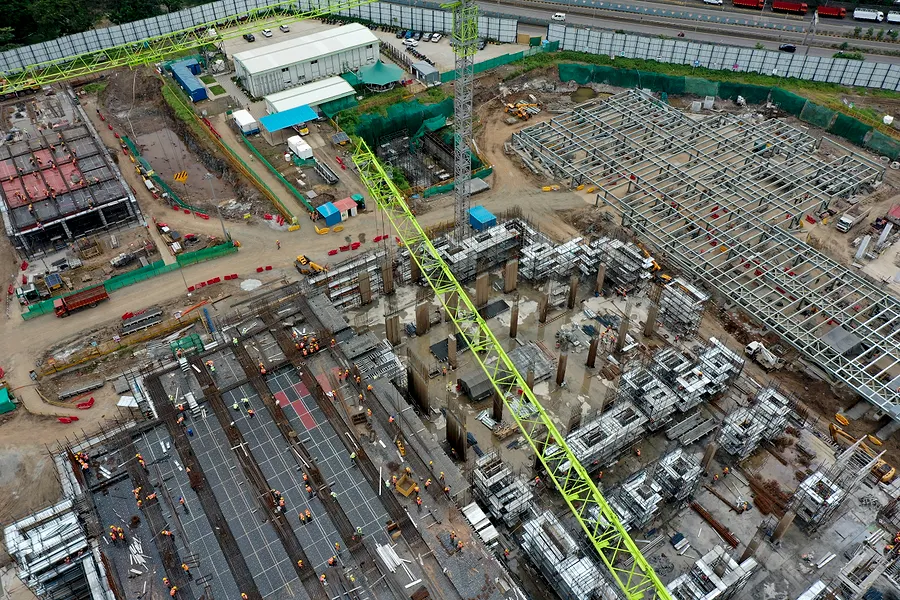
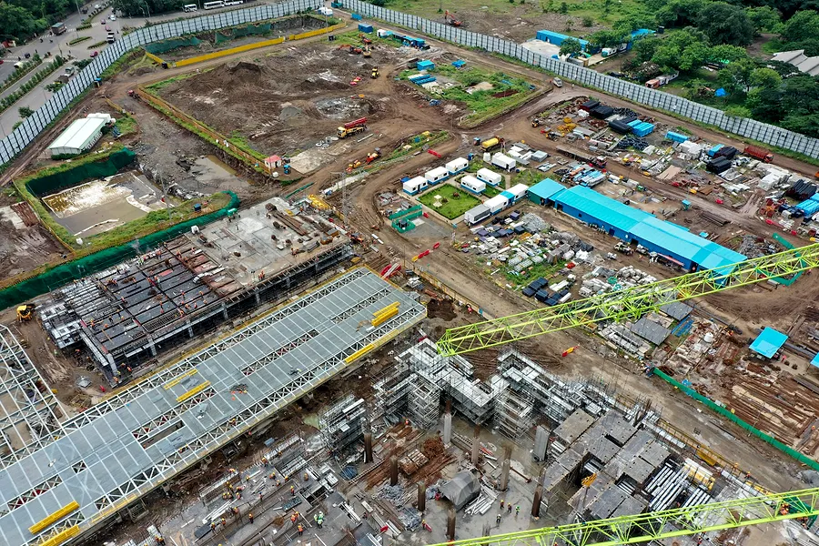
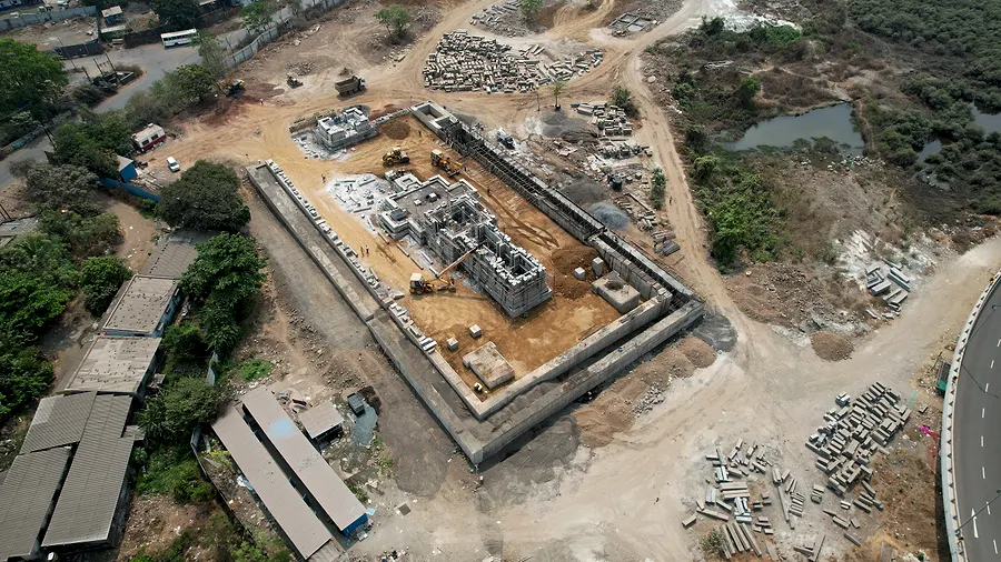
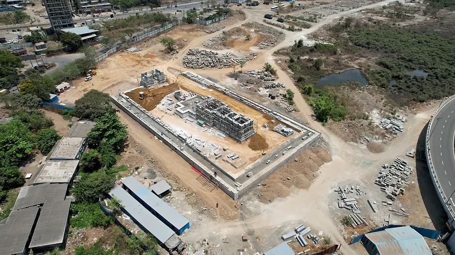
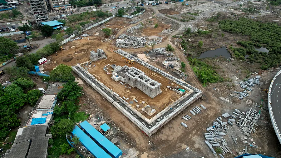
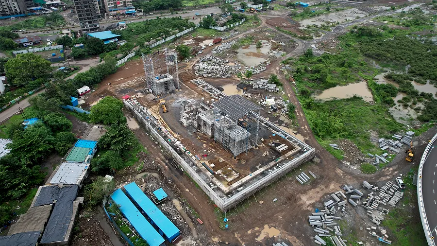
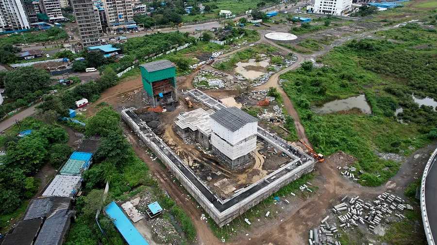
Latest scan of this site. Orbit with the mouse or a finger. Open full screen ↗
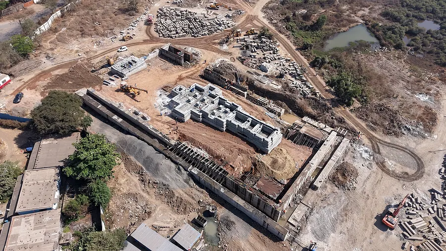
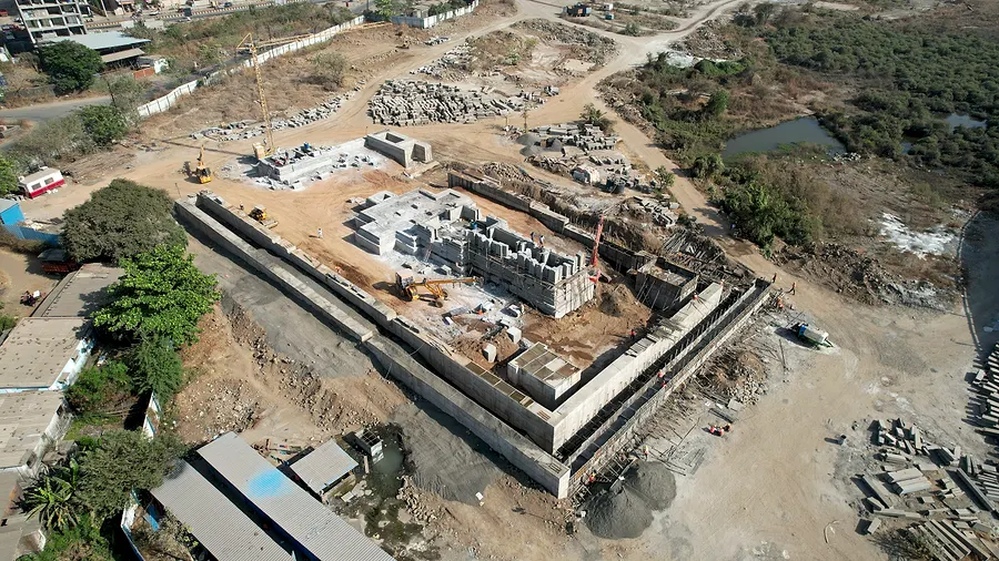
A different Raymond site (Mumbai building scan), shown to demonstrate the 3D deliverable. Open full screen ↗
Progress report · draft
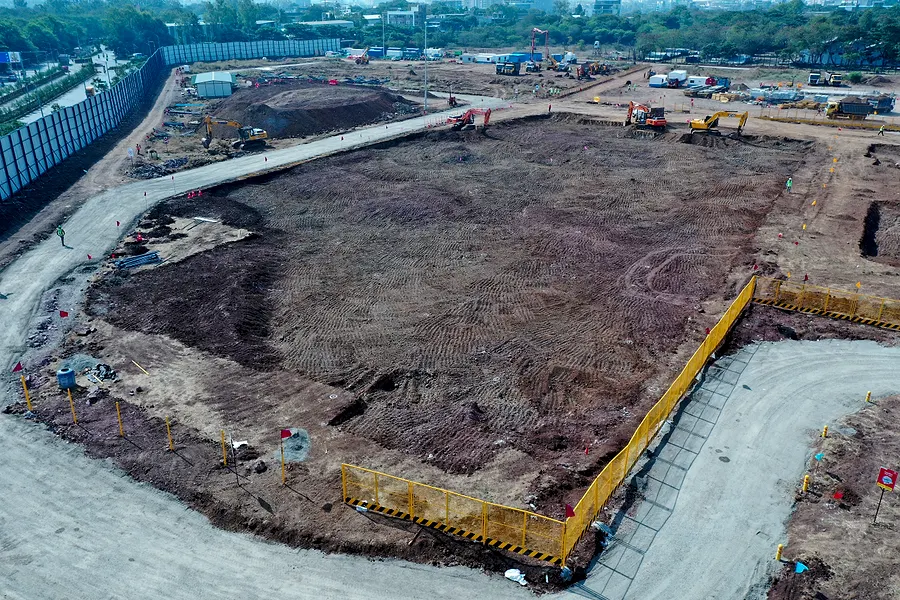
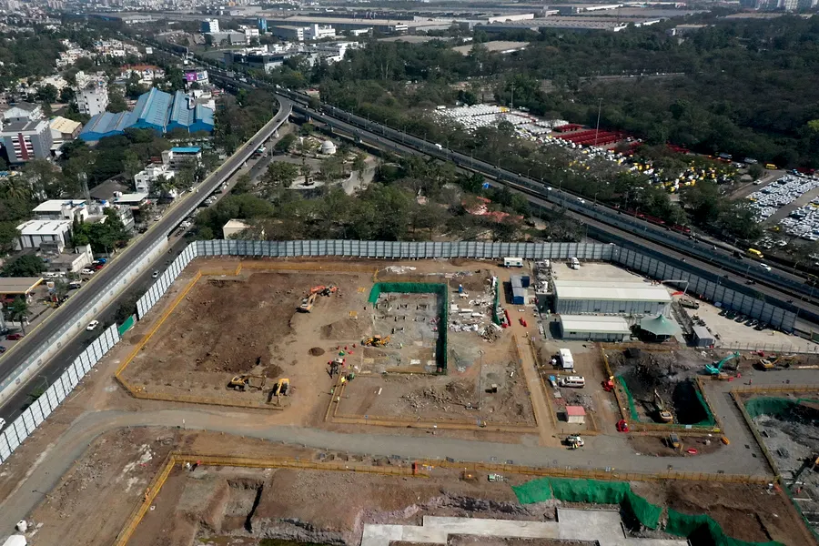
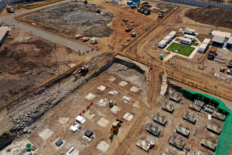
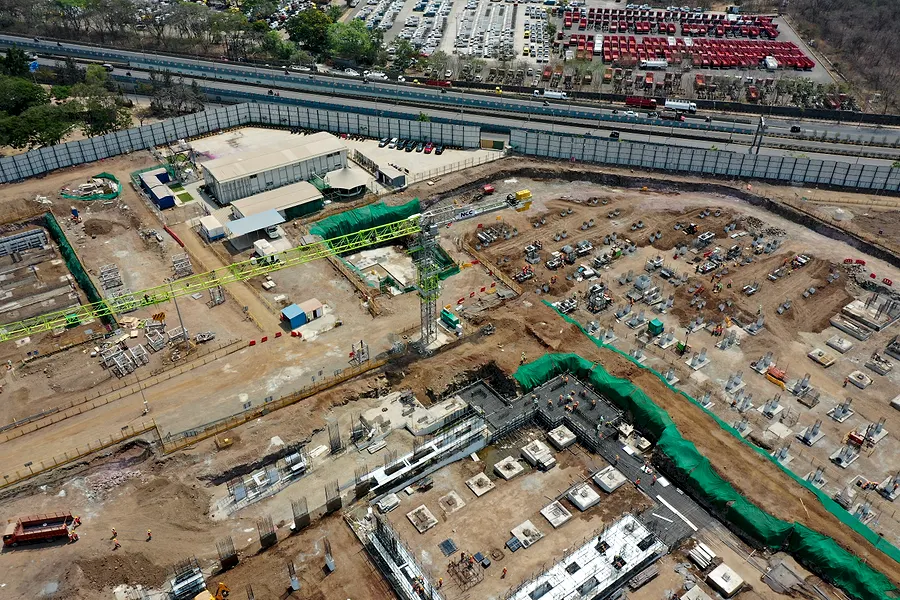
Adani data centre, Pune
Fortnightly capture · 20 flights · May 2023 → Aug 2024 · prepared by Cinosky
- May 2023Bare land. Boundary fenced.
- Jan 2024Excavation. Site offices in.
- Feb 2024Pile caps. Foundations begin.
- Mar 2024Raft poured. Safety nets up.
- Apr 2024Columns. First tower crane.
- May 2024Ground structure across the footprint.
- Jun 2024Monsoon. Structure climbing.
- Jul 2024Steel framing. Second crane.
- Aug 2024Decking on. Upper floors forming.
- Late AugStructure enclosed to upper levels.
Dated aerial record captured by a DGCA-registered operator. In the Plan tier this page also carries % complete per block and cut/fill volumes against the approved drawings.
Progress report · draft
Raymond, Ulwe
Monthly capture · 12 flights · Feb → Sep 2025 · prepared by Cinosky
- Feb 2025Excavation. Perimeter marked out.
- Mar 2025Boundary wall up. Foundations start.
- Apr 2025Plinth complete. Columns rising.
- Late AprGround structure taking shape.
- May 2025Slab poured. Site cleared.
- Jun 2025Superstructure. Monsoon on.
- Sep 2025Enclosed. Roof on.
Dated aerial record captured by a DGCA-registered operator. In the Plan tier this page also carries % complete per block and cut/fill volumes against the approved drawings.
Demo built from two real archives. In the product each flight also adds a 3D scan (Twin tier), and a map view with measurements; this page shows one scan per site.
How it works
You never touch a drone.
- 01
We fly the same mission
Fixed waypoints, altitude and camera angles saved as a mission file, flown on your cadence — so every frame lines up with the last.
- 02
We process offline
Photogrammetry, orthomosaic, 3D scan and the report are produced on our workstations. Nothing heavy runs on your side.
- 03
Your link updates
The viewer gains a new date. Your team opens the same private link; buyers see the embedded version on your own website.
Plans
Priced per site, per month.
-
Monthly
Record
Plot developers · single towers
- Monthly flight, same waypoints
- Dated aerial timeline
- Before / after compare
- RERA-ready PDF each quarter
- Private link for your team
-
Fortnightly
Twin
Active construction · multiple blocks
- Everything in Record
- Fortnightly flights
- 3D scan per flight — scrub time in 3D
- Orthomosaic map with measurements
- Embed on your own website for buyers
-
Fortnightly + engineering
Plan
Large sites · EPC · infrastructure
- Everything in Twin
- Plan / BIM overlay on the model
- % complete per block, cut & fill volumes
- Contractor invoice verification
- Multi-site dashboard
Pricing depends on site area and cadence. Tell us the plot and we quote within a day.